Category: Ciencia

  • Water Droplet Science

    White streaks of motion swirl and swoop all over the image. At the middle of the image is a Teflon knitting needle.
    NASA/Don Pettit

    NASA astronaut Don Pettit demonstrates electrostatic forces using charged water droplets and a knitting needle made of Teflon. This series of overlapping frames from Feb. 19, 2025, displays the unique attraction-repulsion properties of Teflon and charged droplets, similar to how charged particles from the Sun behave when they come in contact with Earth’s magnetic field. Highly energetic particles from space that collide with atoms and molecules in the atmosphere create the aurora borealis.

    Explore more of what Pettit has coined “science of opportunity.”

    Image credit: NASA/Don Pettit

  • NASA’s Wideband Technology Demo Proves Space Missions are Free to Roam

    4 Min Read

    NASA’s Wideband Technology Demo Proves Space Missions are Free to Roam

    An artist’s concept of the Polylingual Experimental Terminal transmitting data in space.

    Credits:
    NASA/Morgan Johnson

    Just like your cellphone stays connected by roaming between networks, NASA’s Polylingual Experimental Terminal, or PExT, technology demonstration is proving space missions can do the same by switching seamlessly between government and commercial communications networks.

    NASA missions rely on critical data to navigate, monitor spacecraft health, and transmit scientific information back to Earth, and this game-changing technology could provide multiple benefits to government and commercial missions by enabling more reliable communications with fewer data interruptions.

    “This mission has reshaped what’s possible for NASA and the U.S. satellite communications industry,” said Kevin Coggins, deputy associate administrator for the agency’s SCaN (Space Communications and Navigation) Program at NASA Headquarters in Washington. “PExT demonstrated that interoperability between government and commercial networks is possible near-Earth, and we’re not stopping there. The success of our commercial space partnerships is clear, and we’ll continue to carry that momentum forward as we expand these capabilities to the Moon and Mars.”

    This mission has reshaped what’s possible for NASA and the U.S. satellite communications industry.

    Kevin Coggins

    Kevin Coggins

    Deputy Associate Administrator for SCaN

    Wideband technology enables data exchange across a broad range of frequencies, helping bridge government and commercial networks as NASA advances commercialization of space communications. By providing interoperability between government and commercial assets, this technology unlocks new advantages not currently available to agency missions.

    As commercial providers continue to advance their technology and add new capabilities to their networks, missions equipped with wideband terminals can integrate these enhancements even after launch and during active operations. The technology also supports NASA’s network integrity by allowing missions to seamlessly switch back and forth between providers if one network faces critical disruptions that would otherwise interfere with timely communications.

    An artist’s concept of the BARD mission in space.
    NASA/Dave Ryan

    “Today, we take seamless cellphone roaming for granted, but in the early days of mobile phones, our devices only worked on one network,” said Greg Heckler, SCaN’s capability development lead at NASA Headquarters. “Our spaceflight missions faced similar limitations—until now. These revolutionary tests prove wideband terminals can connect spacecraft to multiple networks, a huge benefit for early adopter missions transitioning to commercial services in the 2030s.”

    On July 23, the communications demo launched into low Earth orbit aboard the York Space Systems’ BARD mission. Designed by Johns Hopkins Applied Physics Laboratory, the compact wideband terminal communicates over a broad range of the Ka-band frequency, which is commonly used by NASA missions and commercial providers. After completing a series of tests that proved the BARD spacecraft and the demonstration payload were functioning as expected, testing kicked off with NASA’s TDRS (Tracking and Data Relay Satellite) fleet and commercial satellite networks operated by SES Space & Defense and Viasat.

    During each demonstration, the terminal completed critical space communications and navigation operations, ranging from real-time spacecraft tracking and mission commands to high-rate data delivery. By showcasing end-to-end services between the BARD spacecraft, multiple commercial satellites, and mission control on Earth, the wideband terminal showed future NASA missions could become interoperable with government and commercial infrastructure.

    An artist’s concept of the Polylingual Experimental Terminal transmitting data in space.
    NASA/Morgan Johnson

    Due to the flexibility of wideband technology and the innovative nature of this mission, NASA recently extended the Polylingual Experiment Terminal demonstration for an additional 12 months of testing. Extended mission operations will include new direct-to-Earth tests with the Swedish Space Corporation, scheduled to begin in early 2026.

    This technology demonstration will continue testing spaceflight communications capabilities through April 2027. By 2031, NASA plans to purchase satellite relay services for science missions in low Earth orbit from one or more U.S. companies.

    To learn more about this wideband technology demonstration visit:

    PExT – NASA

    The Polylingual Experimental Terminal technology demonstration is funded and managed by NASA’s SCaN Program within the Space Operations Mission Directorate at NASA Headquarters in Washington. York Space Systems provided the host spacecraft. Johns Hopkins Applied Physics Laboratory developed the demonstration payload. Commercial satellite relay demonstrations were conducted in partnership with SES Space & Defense and Viasat.

    An artist’s concept of the BARD mission in space.
    NASA/Dave Ryan
  • Metrics

    2 Min Read

    Metrics

    NSSC Metrics Graphs

    Services Catalog

    Click here to view the FY25 Services Catalog

    The catalogs provide service description, chargeback rate, unit of measure, and service level indicators for each NSSC service.

    Service Level Agreement (SLA)

    Click here to view the Service Level Agreement

    The SLA provides information about roles, responsibilities, rates, and service level indicators for all NASA Centers. The SLA is negotiated on an annual basis in line with the fiscal year. A single SLA is shared by all NASA Centers and signed by the Associate Administrator, Chief Financial Officer, Chief Information Officer, and the Office of Inspector General. The SLA provides for the delivery of specific services from the NSSC to NASA Centers and Headquarters Operations in the areas of:

    • Financial Management
    • Procurement
    • Human Resources
    • Information Technology
    • Agency Business Services

    NSSC Bill (Formerly know as Performance and Utilization Report (PUR))

    *** On-Line Course Management and Training Purchases have been realigned to the OLC &Training Purchases section of the bill in accordance with the realignment of training funds. Center Special Projects have been consolidated into one Special Projects bill with the funding Center identified for each project.***

    FY 2026 – Utilization Reports
    October 2025
    November 2025

    FY 2025 – Utilization Reports

    September 2025
    August 2025
    July 2025
    June 2025
    May 2025

    April 2025
    March 2025
    February 2025
    January 2025
    December 2024
    November 2024
    October 2024

    FY 2024 – Utilization Reports
    September 2024
    August 2024
    July 2024
    June 2024
    May 2024
    April 2024
    March 2024
    February 2024
    January 2024
    December 2023
    November 2023
    October 2023


  • Moon Mascot: NASA Artemis II ZGI Design Challenge

    4 min read

    Preparations for Next Moonwalk Simulations Underway (and Underwater)

    A graphic for the Moon Mascot: NASA Artemis II ZGI Design Challenge.
    Freelancer

    Whose Moon Mascot design will join the Artemis II astronauts on their historic voyage around the Moon in early 2026?

    Between March 7 and Jun. 16, 2025, NASA worked with crowdsourcing company Freelancer to seek design ideas from global creators for a zero gravity indicator that will fly aboard the agency’s Artemis II test flight.

    Zero gravity indicators are small, plush items carried aboard spacecraft to provide a visual indication of when the spacecraft and its crew reach space.

    For the first eight minutes after liftoff, the crew and their indicator nearby will still be pushed into their seats by gravity, and the force of the climb into space. When the main engines of the SLS (Space Launch System) rocket’s core stage cut off, gravity’s restraints are lifted, but the crew will still be strapped safely into their seats – their zero gravity indicator’s ability to float will provide proof that they’ve made it into space.

    Artemis II marks the first time that the public has had a hand in creating a crew’s mascot.

    The Mission

    Over the course of about ten days, four astronauts will travel approximately 685,000 miles from Earth, venture around the Moon, and return home. The flight will—for the first time with astronauts—test NASA’s human deep space exploration capabilities, including the agency’s Exploration Ground Systems, SLS (Space Launch System) rocket, and Orion spacecraft. 

    NASA has a long history of flying zero gravity indicators for human spaceflight missions. Many missions to the International Space Station include a plush item. A plush Snoopy rode inside Orion during NASA’s uncrewed Artemis I mission.

     NASA astronauts Reid Wiseman, Victor Glover, and Christina Koch, and CSA (Canadian Space Agency) astronaut Jeremy Hansen will venture around the Moon and back. The mission is the first crewed flight under NASA’s Artemis campaign and is another step toward missions on the lunar surface and helping the agency prepare for future human missions to Mars.

    The Contest

    The Artemis II astronauts attended SXSW 2025 on March 7, 2025, and sat on a panel to discuss their upcoming mission around the Moon and answer questions from the audience. During the panel, commander Reid Wiseman showed the audience his zero gravity indicator from his Expedition 40 mission to the International Space Station. His zero gravity indicator was a toy giraffe named Giraffiti. Wiseman’s mother gifted Giraffiti to his oldest daughter when she was born. When Wiseman embarked on his first mission to space, his kids gave him Giraffiti to take with him to space.

    “This little guy spent every day with me in my crew quarters,” said Wiseman. “It was a connection back home to my kids.”

    Then, Wiseman and the other crew members revealed that they were opening up the opportunities to people of all ages from all over the world to design the zero gravity indicator for the Artemis II mission around the Moon.

    What better way to fly a mission around the Moon than to invite the public inside NASA’s Orion spacecraft with us and ask for help in designing our zero gravity indicator?

    Reid Wiseman

    Reid Wiseman

    NASA Astronaut and Commander of the Artemis II Mission

    The Moon Mascot contest was hosted by the freelancing and crowdsourcing company Freelancer on behalf of the agency through the NASA Tournament Lab. The contest lasted about three months and received thousands of submissions from over 50 countries. Over the course of the contest, the agency hosted a Twitch stream on NASA’s Twitch channel to discuss zero gravity indicators and practice creating a design with a live artist. Adobe also released an Adobe Express template to help participants with their designs.

    An Adobe Express template for the Moon Mascot competition.
    Adobe

    The Finalists

    On Aug. 22, NASA and Freelancer announced the 25 finalists of the contest. These designs – ideas spanning from Moon-related twists on Earthly creatures to creative visions of exploration and discovery – were selected from more than 2,600 submissions from over 50 countries, including from K-12 students. The finalists represent 10 countries including the United States, Canada, Colombia, Finland, France, Germany, Japan, Peru, Singapore, and Wales.

    The Winner

    Once the crew has selected a final design, NASA’s Thermal Blanket Lab will fabricate it for flight. The indicator will be tethered inside the Orion spacecraft before launch.

    The winner of the contest and the design that will accompany the astronauts on their historic mission will be unveiled closer to launch. Launch is currently targeted for early next year, with launch opportunities as soon as February 2026.

    About the Author

    Thalia K. Patrinos

    Thalia K. Patrinos

    Share

    Details

    Last Updated

    Dec 18, 2025

    Related Terms

  • Curiosity Blog, Sols 4743-4749:  Polygons in the Hollow

    3 min read

    Curiosity Blog, Sols 4743-4749:  Polygons in the Hollow

    A close-up view of tan-orange rocks on the Martian surface that are in a vaguely honeycomb array, with grooves separating the edges of polygonal chunks of surface material.
    NASA’s Mars rover Curiosity acquired this close-up image of polygon-shaped features in the “Monte Grande” boxwork hollow. Similar polygonal patterns in various strata were seen previously, elsewhere in Gale Crater. Curiosity captured the image using its Mars Hand Lens Imager (MAHLI), located on the turret at the end of the rover’s robotic arm, on Dec. 11, 2025 — Sol 4745, or Martian day 4,745 of the Mars Science Laboratory mission — at 16:55:37 UTC.
    NASA/JPL-Caltech/MSSS

    Written by Lucy Lim, Planetary Scientist at NASA’s Goddard Space Flight Center

    Earth Planning Date: Friday, Dec. 12, 2025

    The weekend drive starting from the “Nevado Sajama” drill site brought Curiosity back into the “Monte Grande” boxwork hollow. We’ve been in this hollow before for the “Valle de la Luna” drill campaign, but now that the team has seen the results from both the “Valle de la Luna” and “Nevado Sajama” drilled samples, we’ve decided that there’s more work to do here. 

    Overall science goals here included analysis of the other well-exposed bedrock block in Monte Grande to improve our statistics on the composition of the bedrock in the hollows, and also high-resolution imaging and compositional analysis of portions of the walls of the hollow, other than those that had been covered during the Valle de la Luna campaign. These are part of a systematic mini-campaign to map a transect over the hollow-to-ridge structure from top to bottom at this site.

    The post-drive imaging revealed a surprise — Valle de la Luna’s neighboring block was covered with polygons! As it turned out, the rover’s position during our previous visit for the Valle de la Luna drill campaign happened to have stood in the way of imaging of the polygonal features on this block so this was our first good look at them. We have seen broadly similar polygonal patterns in various strata in Gale Crater before — recently in the layered sulfate units (for instance, during Sols 4532-4533 and Sols 4370-4371) but we hadn’t seen them in the bottom of a boxwork hollow. Interestingly, this block looks more rubbly in texture than many of the previously observed polygon-covered blocks.

    We’re interested in the relationship of the visibly protruding fracture-filling material here to fracture-filling materials seen in previous polygons, and also in the relationship of the polygonal surface on top to the more chaotic-appearing exposures lower on the block, and to the equivalent strata in the nearby wall of the hollow. We therefore planned a super-sized MAHLI mosaic that will support three-dimensional modeling of the upper and lower exposed surfaces of the polygon-bearing block. Several APXS and ChemCam LIBS observations targeted on the polygon centers and polygon ridges were also planned, to measure composition. Meanwhile, Mastcam has been busy planning stereo images of the nearby hollow wall in addition to the various blocks on the hollow floor.

    The hollow also included freshly exposed light-toned material from where the rover had driven over and scuffed some bedrock, so another APXS measurement and a ChemCam LIBS went to the scuffed patch to measure the fresh surface.

    We’ll be driving on Sol 4748. As we drive we’ll be taking a MARDI “sidewalk” observation, to image the ground beneath the rover as we approach the wall for a closer view, and hopefully some contact science in next week’s plans.

    A rover sits on the hilly, orange Martian surface beneath a flat grey sky, surrounded by chunks of rock.
    NASA’s Mars rover Curiosity at the base of Mount Sharp
    NASA/JPL-Caltech/MSSS

    Share

    Details

    Last Updated
    Dec 18, 2025

    Related Terms

  • Betelgeuse and the Crab Nebula: Stellar Death and Rebirth

    3 Min Read

    Betelgeuse and the Crab Nebula: Stellar Death and Rebirth

    Crab Nebula in Multiple Wavelengths
    This highly detailed image of the Crab Nebula was assembled by combining data from five telescopes spanning nearly the entire breadth of the electromagnetic spectrum: The Very Large Array (radio) in red; Spitzer Space Telescope (infrared) in yellow; Hubble Space Telescope (visible) in green; XMM-Newton (ultraviolet) in blue; and Chandra X-ray Observatory (X-ray) in purple.
    Credits:
    NASA, ESA, G. Dubner (IAFE, CONICET-University of Buenos Aires) et al.; A. Loll et al.; T. Temim et al.; F. Seward et al.; VLA/NRAO/AUI/NSF; Chandra/CXC; Spitzer/JPL-Caltech; XMM-Newton/ESA; and Hubble/STScI

    What happens when a star dies? In 2019, Betelgeuse dimmed in brightness, sparking speculation that it may soon explode as a supernova. While it likely won’t explode quite yet, we can preview its fate by observing the nearby Crab Nebula.

    A dark night-sky star map showing the constellations Orion and Taurus outlined with thin lines. Labeled stars include Betelgeuse and Rigel in Orion and Aldebaran in Taurus. The Crab Nebula is marked near the boundary between Taurus and Orion, with many faint background stars scattered across the image.
    A view of the constellations Orion and Taurus, along with notable features: Betelgeuse in Orion, and Aldebaran and the Crab Nebula in Taurus.
    Stellarium Web

    Betelgeuse is easy to find as the red-hued shoulder star of Orion. A variable star, Betelgeuse, usually competes with the brilliant blue-white Rigel for the position of the brightest star in Orion. Betelgeuse is a young star, estimated to be a few million years old, but due to its giant size, it leads a fast and furious life. This massive star, known as a supergiant, exhausted the hydrogen fuel in its core and began to fuse helium instead, which caused the outer layers of the star to cool and swell dramatically in size. Betelgeuse is one of the few stars for which we have any detailed surface observations, due to its vast size – somewhere between the diameters of the orbits of Mars and Jupiter – and its relatively close distance of about 642 light-years. Betelgeuse is also a “runaway star,” with its remarkable speed possibly triggered by a merger with a smaller companion star. If that is the case, Betelgeuse may actually have millions of years left! So, Betelgeuse may not explode soon after all, or it might explode tomorrow! We have much more to learn about this intriguing star.  

    This image of the Crab Nebula combines data from five different telescopes. It is know as the expanding gaseous remnant from a star that self-detonated as a supernova, briefly shining as brightly as 400 million suns.
    This image of the Crab Nebula combines data from five different telescopes: The Very Large Array (radio) in red; Spitzer Space Telescope (infrared) in yellow; Hubble Space Telescope (visible) in green; XMM-Newton (ultraviolet) in blue; and Chandra X-ray Observatory (X-ray) in purple. It is known as the expanding gaseous remnant from a star that self-detonated as a supernova, briefly shining as brightly as 400 million suns.
    NASA, ESA, G. Dubner (IAFE, CONICET-University of Buenos Aires) et al.; A. Loll et al.; T. Temim et al.; F. Seward et al.; VLA/NRAO/AUI/NSF; Chandra/CXC; Spitzer/JPL-Caltech; XMM-Newton/ESA; and Hubble/STScI

    The Crab Nebula (M1) is relatively close to Betelgeuse in the sky, in the nearby constellation of Taurus. Its ghostly, spidery gas clouds result from a massive explosion; a supernova observed by astronomers in 1054! A backyard telescope allows you to see some details. Still, only advanced telescopes reveal the rapidly spinning neutron star found in its center: the last stellar remnant from that cataclysmic event. These gas clouds were created during the giant star’s violent demise and expand ever outward to enrich the universe with heavy elements like silicon, iron, and nickel. These element-rich clouds are like a cosmic fertilizer, making rocky planets like our own Earth possible. Supernovae also send out powerful shock waves that help trigger star formation. In fact, if it weren’t for a long-ago supernova, our solar system – along with all of us – wouldn’t exist! You can learn much more about the Crab Nebula in a video from NASA’s James Webb Space Telescope: bit.ly/CrabNebulaVisual

    Want to know more about the life cycle of stars? Explore stellar evolution with “The Lives of Stars” activity and handout at bit.ly/starlifeanddeath, part of our SUPERNOVA! toolkit.

    Originally posted by Dave Prosper: February 2020

    Last Updated by Kat Troche: December 2025

  • Hubble Glimpses Galactic Gas Making a Getaway

    2 min read

    Hubble Glimpses Galactic Gas Making a Getaway

    A nearly edge-on spiral galaxy. Its disk holds pink light from star-forming nebulae and blue light from clusters of hot stars. Thick dark clouds of dust block the strong white light from galaxy’s center. A faint, glowing halo of gas surrounds the disk, fading into the black background of space. A bluish plume of gas also extends from the galaxy’s core extending toward the lower-right corner of the image.
    This NASA/ESA Hubble Space Telescope image features the galaxy NGC 4388, a member of the Virgo galaxy cluster.
    ESA/Hubble & NASA, S. Veilleux, J. Wang, J. Greene

    A sideways spiral galaxy shines in this NASA/ESA Hubble Space Telescope image. Located about 60 million light-years away in the constellation Virgo (the Maiden), NGC 4388 is a resident of the Virgo galaxy cluster. This enormous cluster of galaxies contains more than a thousand members and is the nearest large galaxy cluster to the Milky Way.

    NGC 4388 appears to tilt at an extreme angle relative to our point of view, giving us a nearly edge-on prospect of the galaxy. This perspective reveals a curious feature that wasn’t visible in a previous Hubble image of this galaxy released in 2016: a plume of gas from the galaxy’s nucleus, here seen billowing out from the galaxy’s disk toward the lower-right corner of the image. But where did this outflow come from, and why does it glow?

    The answer likely lies in the vast stretches of space that separate the galaxies of the Virgo cluster. Though the space between galaxies appears empty, this space is occupied by hot wisps of gas called the intracluster medium. As NGC 4388 moves within the Virgo cluster, it plunges through the intracluster medium. Pressure from hot intracluster gas whisks away gas from within NGC 4388’s disk, causing it to trail behind as NGC 4388 moves.

    The source of the ionizing energy that causes this gas cloud to glow is more uncertain. Researchers suspect that some of the energy comes from the center of the galaxy, where a supermassive black hole spins gas around it into a superheated disk. The blazing radiation from this disk might ionize the gas closest to the galaxy, while shock waves might be responsible for ionizing filaments of gas farther out.

    This image incorporates new data, including several additional wavelengths of light, that bring the ionized gas cloud into view. The image holds data from several observing programs that aim to illuminate galaxies with active black holes at their centers.

    Media Contact:

    Claire Andreoli (claire.andreoli@nasa.gov)
    NASA’s Goddard Space Flight CenterGreenbelt, MD

  • NASA Announces 2025 International Space Apps Challenge Global Winners

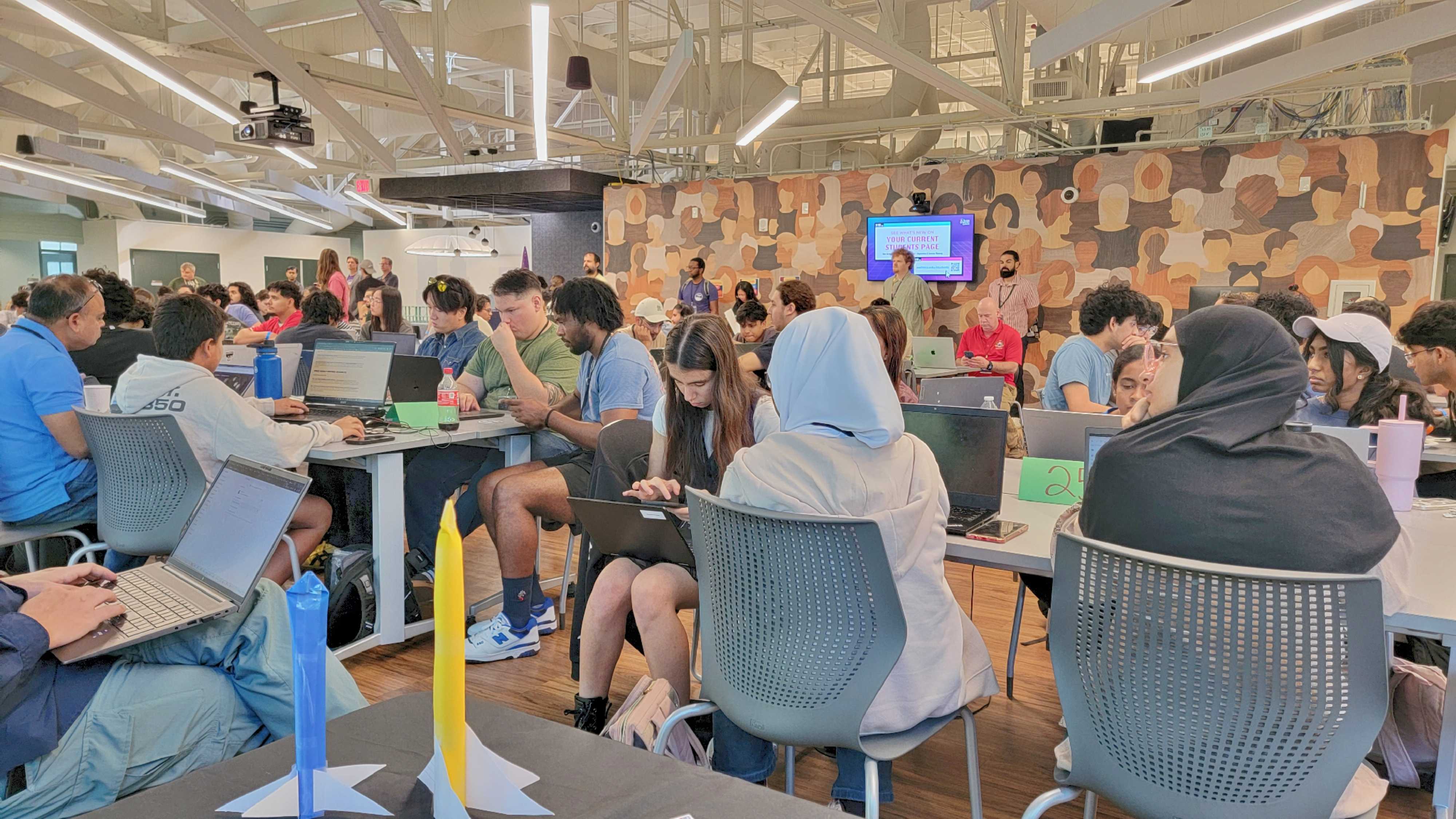
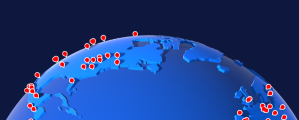
    NASA Space Apps announced Thursday 10 winners of the 2025 NASA Space Apps Challenge. During this two-day hackathon, participants gathered at 551 local events across 167 countries and territories to showcase their STEM skills and proposed ways to transform NASA’s open data into actionable tools.

    crowd of people in a large room
    Participants work on their projects at the NASA Space Apps Challenge in Austin, Texas, at one of more than 50 local events held in the United States.
    NASA Space Apps

    More than 114,000 participants came together to address challenges created by NASA subject matter experts. These challenges ranged in complexity and topic, tasking participants with everything from leveraging artificial intelligence, to improving access to NASA research, and developing tools to evaluate air quality.

    “The Space Apps Challenge puts NASA’s free and open data into the hands of explorers around the world,” said Karen St. Germain, director, NASA Earth Science Division at NASA Headquarters in Washington. “With participants as varied as NASA enthusiasts, future scientists, regional decision-makers and members of the public, this challenge demonstrates the excitement of discovery and the real-world applications of agency data. Space apps also fosters a global community of creative and innovative ideas.”

    The winners were determined from more than 11,500 project submissions and judged by subject matter experts from NASA and agency partners:

    Best Use of Science Award: SpaceGenes+
    Team Members: Saloni T.
    Challenge: Build a Space Biology Knowledge Engine
    Country/Territory: Germany

    Team SpaceGenes+ created an interactive dashboard designed to help researchers uncover how radiation and microgravity together impact astronaut health at the molecular level. It gives researchers and mission planners an easy way to identify important molecular changes, supporting more effective protection strategies for long-duration spaceflight.
    Learn more about SpaceGenes+’ project

    Best Use of Data Award: Resonant Exoplanets
    Team Members: Adhvaidh S., Gabriel S., Jack A., Sahil S.
    Challenge: A World Away: Hunting for Exoplanets with AI
    Country/Territory: United States 
     
    Team Resonant Exoplanets developed an AI-powered system that ingests large sets of telescope and satellite data, including spectra from missions like the James Webb Space Telescope. This tool automatically analyzes data for exoplanets and detects possible biosignatures, rather than identifying them manually.
    Learn more about Resonant Exoplanets’ project

    Best Use of Technology Award: Twisters
    Team Members: Fernando A., Marcelo T., Mariana D., Regina R., Regina F.
    Challenge: Will It Rain on My Parade?
    Country/Territory: Mexico
     
    Team Twisters developed SkySense, a web-app platform that uses NASA Earth observation data and AI analysis to provide ultra-local, personalized weather predictions and to analyze weather variables such as rain, wind, temperature, humidity, and visibility, generating real-time risk assessments and suggesting the safest time windows for activities.
    Learn more about Twisters’ project

    Galactic Impact Award: Astro Sweepers: We Catch What Space Leaves Behind
    Team Members: Harshiv T., Pragathy S., Pratik J., Sherlin D., Yousra H., Zienab E.
    Challenge: Commercializing Low Earth Orbit (LEO)
    Country/Territory: Universal Event
     
    Team Astro Sweepers developed an end-to-end orbital debris compliance and risk intelligence platform that automatically ingests public orbital data to generate Debris Assessment Software reports and compute the Astro Sweepers Risk Index  for every resident space object. This project considers the operational, regulatory, and environmental challenges of commercialized space travel.
    Learn more about Astro Sweepers’ project

    Best Mission Concept Award: PureFlow
    Team Members: Esthefany M., João F., Laiza L., Lara D., Pedro H., Thayane D. 
    Challenge: Your Home in Space: The Habitat Layout Creator
    Country/Territory: Brazil
     
    PureFlow developed an interactive systems engineering platform that allows users to design, model in 3D, and validate space habitats, and then test the design against real space-weather threats, such as solar storms. This system considers the critical functions required for living in space, including waste management, power, life support, communications, and more.
    Learn more about PureFlows’ project

    Most Inspirational Award: Photonics Odyssey
    Team Members: Manish D., Deeraj K., Prasanth G., Rajalingam N., Rashi M., Sakthi R.
    Challenge: Commercializing Low Earth Orbit (LEO)
    Country/Territory: India
     
    Photonics Odyssey reimagined satellite internet as a sovereign national infrastructure rather than a private service, proposing a phased-array antenna approach that reduces ground dependency and expands broadband access to remote regions of India. The concept aims to help connect more than 700 million people who lack access to broadband internet.
    Learn more about Photonics Odysseys’ project

    Best Use of Storytelling Award: HerCode Space
    Team Members: Alice R., Joselyn R., Paula C., Pierina J.
    Challenge: Stellar Stories: Space Weather Through the Eyes of Earthlings
    Country/Territory: Universal Event
     
    HerCode Space combined NASA data and heliophysics concepts with powerful storytelling and vibrant illustrations to teach kids how space weather affects daily life and why it matters. HerCode Science hopes their story, “A Solar Tale,” can bridge science and imagination, and bring heliophysics to life in classrooms, libraries, and outreach programs.
    Learn more about HerCode Spaces’ project

    Global Connection Award: Gaia+LEO
    Team Members: Adam H., Katia L., Prajwal S., Upendra K. 
    Challenge: Commercializing Low Earth Orbit (LEO)
    Country/Territory: United States
     
    Team Gaia+LEO developed a mixed-integer optimization framework that co-designs orbital and terrestrial data-center networks to support large-scale AI training and climate modeling in orbit. Their goal is to reduce the power, and water demands of Earth-based systems and help accelerate the shift toward space-based, green computing within the emerging orbital economy.
    Learn more about Gaia+LEOs’ project

    Art & Technology Award: Zumorroda-X
    Team Members: Alaa A., Esraa A., Malak S., Mennatulla E.
    Challenge: NASA Farm Navigators: Using NASA Data Exploration in Agriculture
    Country/Territory: Egypt
     
    Team Zumorroda-X created mini games that allow players to step into the shoes of a farmer who sets off on an epic journey around the world. Through this game, players can learn how farmers globally adapt to heat waves, flooding, and other environmental challenges. 
    Learn more about Zumorroda-Xs’ project

    Local Impact Award: QUEÑARIS
    Team Members: Borax Q., Carlos Y., Marcelo S., Máximo S., Oscar M., Pamela P.
    Challenge: BloomWatch: An Earth Observation Application for Global Flowering Phenology
    Country/Territory: Peru
     
    Team QUEÑARIS’ project addresses critical water scarcity in Peru’s second-largest city, Arequipa, caused by the degradation of queñua forests, which are vital for water retention. Their platform combines native microorganisms, NASA satellite data, drones, and artificial intelligence to accelerate tree growth, identify the best areas for reforestation, and monitor ecosystem health.
    Learn more about QUEÑARIS’ project

    Stay up to date with #SpaceApps by following these accounts:
    X: @SpaceApps 
    Instagram: @nasa_spaceapps 
    Facebook: @spaceappschallenge 
    YouTube: @NASASpaceAppsChallenge

    NASA Space Apps is funded by NASA’s Earth Science Division through a contract with Booz Allen Hamilton, Mindgrub, and SecondMuse.

    To learn more about what inspired these winning projects, visit:

    https://www.spaceappschallenge.org

    Details

    Last Updated

    Dec 19, 2025

    Related Terms

  • Hi ya! Hyha

    A color photograph from the Martian surface shows mostly smooth, pale orange colored terrain beneath a sky of flat, warm beige; the ground extends into the distance where an undulating line of gentle peaks forms a horizon about two-thirds of the way above the bottom of the frame. Closer to the foreground the terrain slopes from the upper left of the image toward lower right, with scattered rocks and streaks of gray along the ground.
    This image from NASA’s Mars Perseverance rover shows a potential megablock on the Jezero crater rim, taken by the Mastcam-Z instrument’s “right eye.” Mastcam-Z is a pair of cameras located high on the rover’s mast. Perseverance acquired this image looking east across the rim heading towards “Lac de Charmes” on Dec. 7, 2025 — Sol 1706, or Martian day 1,706 of the Mars 2020 mission — at the local mean solar time of 13:38:46.
    NASA/JPL-Caltech/ASU

    Written by Margaret Deahn, Ph.D. student at Purdue University 

    NASA’s Mars 2020 rover is currently trekking towards exciting new terrain. After roughly four months of climbing up and over the rim of Jezero crater, the rover is taking a charming tour of the plains just beyond the western crater rim, fittingly named “Lac de Charmes.” This area just beyond Jezero’s rim will be the prime place to search for pre-Jezero ancient bedrock and Jezero impactites — rocks produced or affected by the impact event that created Jezero crater.  

    The formation of a complex crater like Jezero is, well… complex. Scientists who study impact craters like to split the formation process into three stages: contact & compression (when the impactor hits), excavation (when materials are thrown out of the crater), and modification (when gravity causes everything to collapse). This process happens incredibly fast, fracturing the impacted rock and even melting some of the target material. Sometimes on Earth, the classic “bowl” shaped crater has been completely weathered and unrecognizable, so geologists are able to identify craters by the remnants of their impactites. Just when you thought it couldn’t get any more complicated — Jezero crater’s rim is located on the rim of another, even bigger basin called Isidis. That means there is an opportunity to have impactites from both cratering events exposed in and just around the rim — some of which could be several billions of years old! We may have already encountered one of these blocks on our trek towards Lac de Charmes. In the foreground of this image taken by the Mastcam-Z instrument on the rover, there is a potential impactite called a “megablock” that the team has named “Hyha.” We can actually see this block from orbit, it is that large! The team is excited to continue exploring these ancient rocks as we take our next steps off Jezero’s rim.

  • NASA’s Perseverance Mars Rover Ready to Roll for Miles in Years Ahead

    NASA’s Perseverance Mars rover captured this view of a location nicknamed “Mont Musard” on Sept. 8, 2025. Made up of three images, the panorama also captures another region, “Lac de Charmes,” where the rover’s team will be looking for more rock core samples to collect in the year ahead.
    NASA/JPL-Caltech/ASU/MSSS

    After nearly five years on Mars, NASA’s Perseverance rover has traveled almost 25 miles (40 kilometers), and the mission team has been busy testing the rover’s durability and gathering new science findings on the way to a new region nicknamed “Lac de Charmes,” where it will be searching for rocks to sample in the coming year.

    Like its predecessor Curiosity, which has been exploring a different region of Mars since 2012, Perseverance was made for the long haul. NASA’s Jet Propulsion Laboratory in Southern California, which built Perseverance and leads the mission, has continued testing the rover’s parts here on Earth to make sure the six-wheeled scientist will be strong for years to come. This past summer, JPL certified that the rotary actuators that turn the rover’s wheels can perform optimally for at least another 37 miles (60 kilometers); comparable brake testing is underway as well.

    Over the past two years, engineers have extensively evaluated nearly all the vehicle’s subsystems in this way, concluding that they can operate until at least 2031.

    NASA’s Perseverance used its navigation cameras to capture its record-breaking drive of 1,350.7 feet (411.7 meters) on June 19, 2025. The navcam images were combined with rover data and placed into a 3D virtual environment, resulting in this reconstruction with virtual frames inserted about every 4 inches (0.1 meters) of drive progress. Credit: NASA/JPL-Caltech

    “These tests show the rover is in excellent shape,” said Perseverance’s deputy project manager, Steve Lee of JPL, who presented the results on Wednesday at the American Geophysical Union’s annual meeting, the largest gathering of planetary scientists in the United States. “All the systems are fully capable of supporting a very long-term mission to extensively explore this fascinating region of Mars.”

    Perseverance has been driving through Mars’ Jezero Crater, the site of an ancient lake and river system, where it has been collecting scientifically compelling rock core samples. In fact, in September, the team announced that a sample from a rock nicknamed “Cheyava Falls” contains a potential fingerprint of past microbial life.

    More efficient roving

    In addition to a hefty suite of six science instruments, Perseverance packs more autonomous capabilities than past rovers. A paper published recently in IEEE Transactions on Field Robotics highlights an autonomous planning tool called Enhanced Autonomous Navigation, or ENav. The software looks up to 50 feet (15 meters) ahead for potential hazards, then chooses a path without obstacles and tells Perseverance’s wheels how to steer there.

    Engineers at JPL meticulously plan each day of the rover’s activities on Mars. But once the rover starts driving, it’s on its own and sometimes has to react to unexpected obstacles in the terrain. Past rovers could do this to some degree, but not if these obstacles were clustered near each other. They also couldn’t react as far in advance, resulting in the vehicles driving slower while approaching sand pits, rocks, and ledges. In contrast, ENav’s algorithm evaluates each rover wheel independently against the elevation of terrain, trade-offs between different routes, and “keep-in” or “keep-out” areas marked by human operators for the path ahead.

    “More than 90% of Perseverance’s journey has relied on autonomous driving, making it possible to quickly collect a diverse range of samples,” said JPL autonomy researcher Hiro Ono, a paper lead author. “As humans go to the Moon and even Mars in the future, long-range autonomous driving will become more critical to exploring these worlds.”

    New science

    A paper published Wednesday in Science details what Perseverance discovered in the “Margin Unit,” a geologic area at the margin, or inner edge, of Jezero Crater. The rover collected three samples from that region. Scientists think these samples may be particularly useful for showing how ancient rocks from Mars’ deep interior interacted with water and the atmosphere, helping create conditions supportive for life.

    From September 2023 to November 2024, Perseverance ascended 1,312 feet (400 meters) of the Margin Unit, studying rocks along the way — especially those containing the mineral olivine. Scientists use minerals as timekeepers because crystals within them can record details about the precise moment and conditions in which they formed.

    Jezero Crater and the surrounding area holds large reserves of olivine, which forms at high temperatures, typically deep within a planet, and offers a snapshot of what was going on in the planet’s interior. Scientists think the Margin Unit’s olivine was made in an intrusion, a process where magma pushes into underground layers and cools into igneous rock. In this case, erosion later exposed that rock to the surface, where it could interact with water from the crater’s ancient lake and carbon dioxide, which was abundant in the planet’s early atmosphere.

    Those interactions form new minerals called carbonates, which can preserve signs of past life, along with clues as to how Mars’ atmosphere changed over time.

    “This combination of olivine and carbonate was a major factor in the choice to land at Jezero Crater,” said the new paper’s lead author, Perseverance science team member Ken Williford of Blue Marble Space Institute of Science in Seattle. “These minerals are powerful recorders of planetary evolution and the potential for life.”

    Together, the olivine and carbonates record the interplay between rock, water, and atmosphere inside the crater, including how each changed over time. The Margin Unit’s olivine appeared to have been altered by water at the base of the unit, where it would have been submerged. But the higher Perseverance went, the more the olivine bore textures associated with magma chambers, like crystallization, and fewer signs of water alteration.

    As Perseverance leaves the Margin Unit behind for Lac de Charmes, the team will have the chance to collect new olivine-rich samples and compare the differences between the two areas.

    More about Perseverance

    Managed for NASA by Caltech, NASA’s Jet Propulsion Laboratory in Southern California built and manages operations of the Perseverance rover on behalf of the agency’s Science Mission Directorate as part of NASA’s Mars Exploration Program portfolio.

    To learn more about Perseverance, visit:

    https://science.nasa.gov/mission/mars-2020-perseverance

    News Media Contacts

    Andrew Good / DC Agle
    Jet Propulsion Laboratory, Pasadena, Calif.
    818-393-2433 / 818-393-9011
    andrew.c.good@jpl.nasa.gov / agle@jpl.nasa.gov

    Karen Fox / Molly Wasser
    NASA Headquarters, Washington
    240-285-5155 / 240-419-1732
    karen.c.fox@nasa.gov / molly.l.wasser@nasa.gov

    2025-143